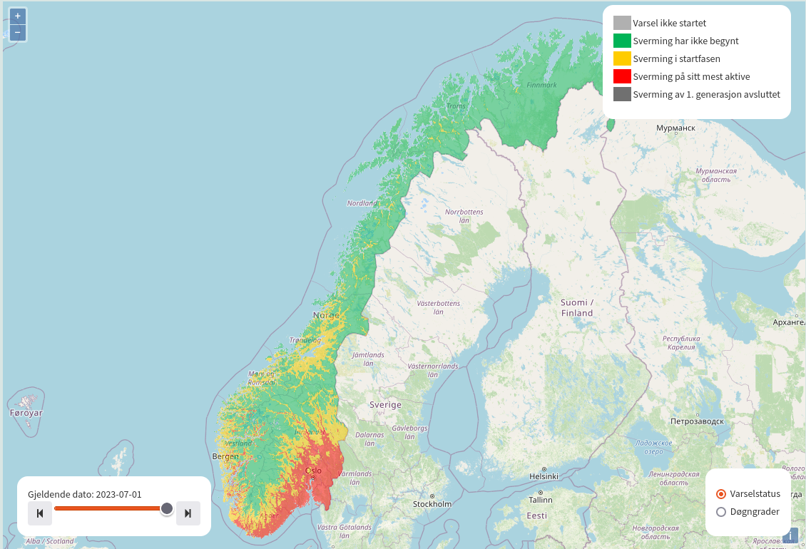
VIPS risikokart
Risikokart viser varsler for ulike planteskadegjørere basert på værdata i 1x1 km rutenett. Varslene viser om værforholdene ligger til rette for at en skadegjørere kan utvikle eller spre seg, forutsatt at andre biologiske forutsetninger er oppfylt.
Informasjonen i kartet gir en regional oversikt uten å være avhengig av faste værstasjoner. Tilsvarende varsler for ulike skadegjørere beregnes også med data fra værstasjoner på faste lokasjoner, hvor mer detaljerte beregninger kan hentes opp via visningen i kartet på VIPS-forsida.
Brukere av VIPS må selv vurdere om skadegjøreren finnes i det aktuelle området, om vertplanter er mottakelige, og om det er behov for tiltak. Det anbefales å ta kontakt med sin lokale rådgiver for vurdering av aktuelle tiltak.
Datagrunnlag
Varslingsmodeller for ulike skadegjørere beregnes i rutenett a 1x1km med værdata fra reanalyserte data og værprognoser fra Meteorologisk Institutt. Varslene oppdateres en gang per døgn, og kartene har en tidsskala hvor det er mulig å navigere i tid fra modellens startdato og inntil 2 døgn frem i tid i inneværende sesong.
Utvikling av risikokart
Gulrotfluens svermetidspunkt var den første modellen som ble satt opp for visning i risikokart. Dette var et resultat fra prosjektet "Grid-baserte varsler i VIPS", med finansiering fra Landbruksdirektoratet gjennom Handlingsplan for bærekraftig bruk av plantevernmidler i 2023. En testversjon var i drift i 2023, og kartet lanseres for bruk i VIPS i 2024.
Risikokartenes generelle datagrunnlag og potensiale for integrering av ulike modeller er resultat av synergier mellom flere prosjekt, deriblant IPM Decisions og MaDiPHS (Malawi Digital Plant Health Service), hvor risikokart for skadegjørere skal settes opp i tjenester med relevans for brukere i Europa, og i Malawi.
Risikokart i IPM Decisions (Europa): https://platform.ipmdecisions.net/
Risikokart for Malawi - følg med her: https://madiphs.org/